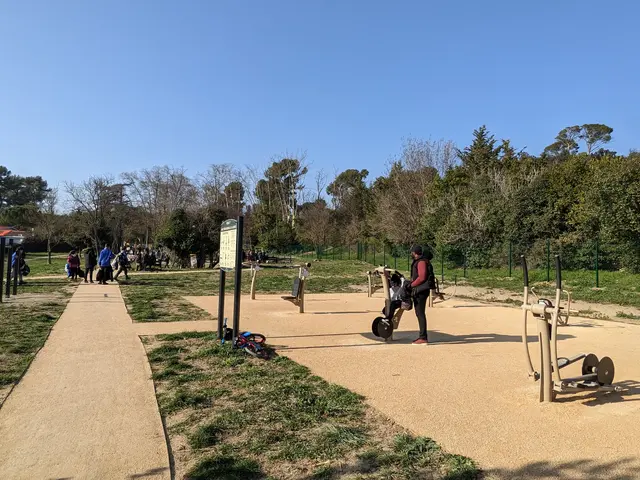
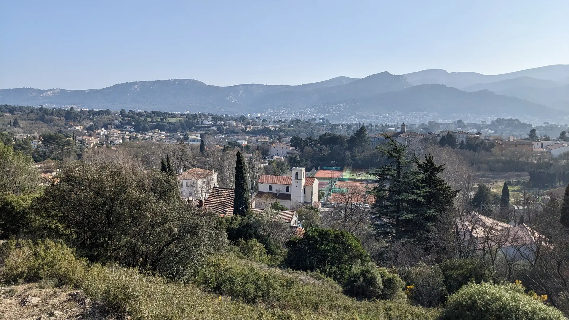
Marseille Durable
  See photos (5)

Hiking through the countryside, east of Marseille

Sport, Pedestrian sports, Hiking itinerary in Marseille 11ème
7.1 km
2h 30min
Medium
  • A walk to discover the outlying districts of the city center, nestled at the foot of the Garlaban massif and crossed by diversions of the Marseille canal. At the same time, you'll come across a trail in the footsteps of Marcel Pagnol.

  • The starting point for this walk is in Eoures (0), at the "Eoures village" bus stop. To reach it from central Marseille, take RTM bus line 12 from the "Timone" metro station.

    Pass the church (1), the "aux tropiques" shop (2) and then fork left onto boulevard du Monument until the next intersection with rue Arnould, where you turn left. Go straight ahead, skirting a large park which conceals a beautiful, unseen country house, until you reach a traffic circle.

    Go down Rue de Ruissatel....
    The starting point for this walk is in Eoures (0), at the "Eoures village" bus stop. To reach it from central Marseille, take RTM bus line 12 from the "Timone" metro station.

    Pass the church (1), the "aux tropiques" shop (2) and then fork left onto boulevard du Monument until the next intersection with rue Arnould, where you turn left. Go straight ahead, skirting a large park which conceals a beautiful, unseen country house, until you reach a traffic circle.

    Go down Rue de Ruissatel. You'd be forgiven for thinking that this was once the countryside, with a handful of beautiful mansions, bastides and, above all, a majority of farmland producing early vegetables and olive oil. Green spaces at the foot of the 445-meter-high Ruissatel hill.

    You've now reached the heart of the village of Les Camoins.

    On your right, a gate leads to a modern fountain (3). Go around the church of Sainte-Agathe and down the rue of the same name, then the rue Saint-Roch. If the church is open, you can still admire a wooden bust of this Saint-Roch. In the 19th century, this narrow street was home to a post office, where the omnibus to Marseille departed and arrived. For the younger generation, the omnibus is the ancestor of the bus. In those days, the vehicle was horse-drawn.

    Rue Saint-Roch leads to montée d'Eoures, which you follow to the right for a few meters, then left into traverse de la Penne. You'll continue to pass through suburban areas with beautiful detached houses. Take a look at number 63 (4).

    After a few steps, turn right onto the traverse de Saint-Menet. At number 21, you'll find a rare plot of undeveloped land, currently undeveloped. Will it resist? In the distance, the view is unobstructed over three mountains in the Calanques massif: Lantin, Saint-Cyr and Carpiagne. Once you've passed nr. 27 of the traverse, walk a little further to reach a secret passage in the wall, which we invite you to use. Marcel Pagnol and his parents' route to Bastide Neuve must have looked like this at times. We love it here at the Marseille tourist office (5).

    You have to cross the housing estate, part of the Parc des Sept Collines, which refers to the hills you could see in the past, when this was still farmland. Keep to the right down rue Hilaire Curtil until it opens onto a wider road, la traverse de la Buzine, which you have to walk down until you reach a nursery school.

    Walk along the school's fence to reach the entrance to the Parc des 7 Collines (6). Cross the park to reach the Château de la Buzine forecourt (7).

    Leave the site through the main gate and join the old panel opposite, which gives details of life in the bastide and the Château de la Buzine. Behind it, a small path runs along the road to the left, allowing you to take a short stroll through the greenery. In the distance, on the right, you'll see a very tall building with two towers and part of its roof topped by a lighthouse. This is the Lycée Paul Mélizan (8).

    At the end of the field, go back up to the road, the traverse de la Buzine, and go straight ahead. Then take the first right, the chemin de Saint-Menet aux Accates. This becomes a small footpath alongside a dry-stone wall, then joins the D4A departmental road, which you must cross to continue towards the historic heart of Les Accates. Until you reach the village church, the path is still called "chemin de Saint-Menet aux Accates".

    When you reach the Saint-Christophe square and crossroads, which are pleasantly shaded by several plane trees, walk along the restaurant building and up the Fenêtres Rouges crossroads (9) until you reach the small Jeanne d'Arc square, recognizable by a pretty house on the corner with blue shutters. Turn left, then right at the end to climb back up. You'll gain height as you follow a tarmac path winding through the vegetation to the Accates cemetery. There's a bench in the shade of several holm oaks, where you can take a break.

    To the left of the bench, take a path which, after offering a last bird's-eye view of the cemetery, joins a fenced property which you must walk along to the right.

    Walk under the pines along the fence and you'll soon reach a carriage road, the Canal au Val path. The first landmark to confirm that you're in the right place is a fig tree growing like a bush with several trunks in a field on your right. Shortly afterwards, you'll come to the Camoins diversion, a branch of the Marseille canal that supplies water to the land in the neighborhoods you pass through.

    The road then changes its name (although it's not clear whether there are any signs in situ) to Chemin de la Salette, marking the invisible dividing line between the Accates (left) and Valentine (right) districts. Follow this until you reach a junction with the Chemin des Accates, which you should take down to no. 61. At this point, you can leave the road to enter a natural area, a verdant park, and follow the path to the other end, marked by the ruins of an ancient bastide, La Denise (10).

    Cross the traffic circle to enter and cross the Denise departmental park (11).

    Leave the park on the D4A departmental road. Follow this road to the left (past the Fabrique bakery) to reach the RTM "Lycée Paul Mélizan" bus stop, where you can take lines 12, 12B or 12S to return to the town center and La Timone, the collective terminus for these 3 bus lines.
  • Departure
    Marseille 11ème
  • Difference in height
    100 m
  • Environment
    • Close to a public transportation
    • In the country
  • Spoken languages
    • French
  • Documentation
    GPX / KML files allow you to export the trail of your hike to your GPS (or other navigation tool)
Points of interest
1 Village of Eoures
Located on the road from Camoins to Aubagne and at the foot of the Ruisatel hill, a detached foothill of the Garlaban massif. Before the 20th century, there were fewer than 300 inhabitants in Eoures, and this small village was devoted to agriculture. The main crops grown here were early vegetables (tomatoes, broad beans, peas).
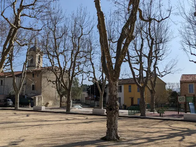
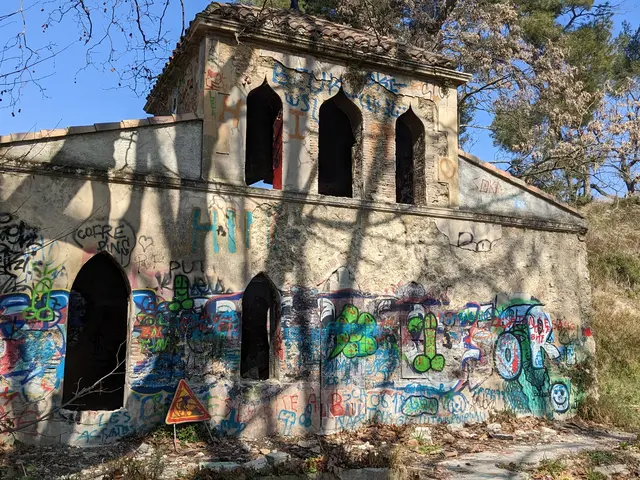
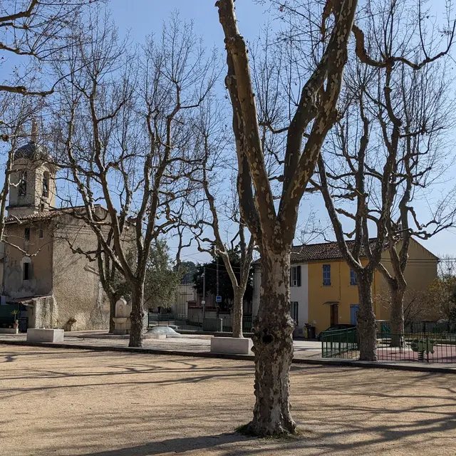
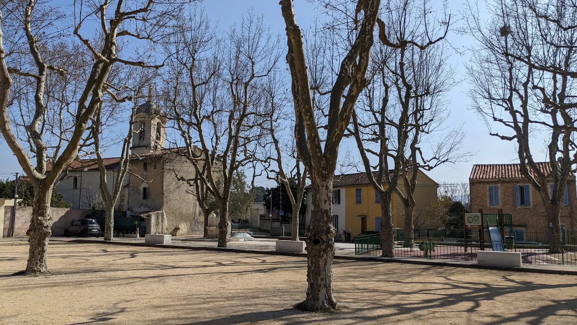
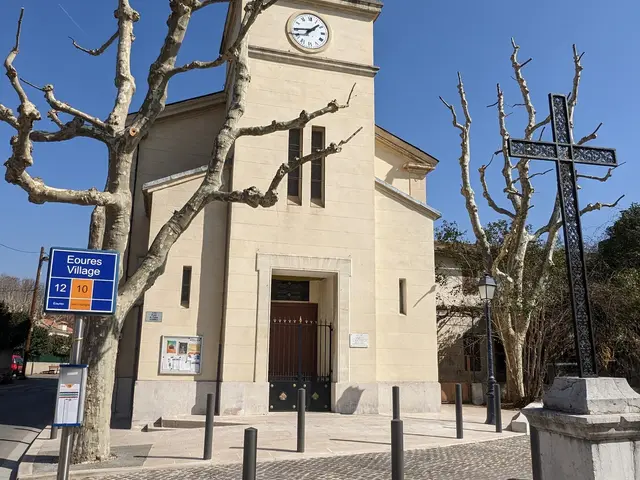
place village Eoures©hkotlcm.jpg
2 Church of Eoures
Nothing remains of the "primitive" church dating from the 10th century. At the end of the 19th century, so many changes were made to the building that it looked as if the church had been completely rebuilt. The ceiling was transformed into a vault, the walls painted and the Romanesque bell tower added. Dedicated to the Nativity of the Blessed Virgin Mary, also known as "Notre Dame d'Eoures", the church is surmounted by a 3.20-metre high Virgin Mary, whose construction was completed by the great architect Henri Espérandieu. However, he did not see the fruits of his labour as he died on 11 September 1874, a year before the actual completion of the work in 1875.
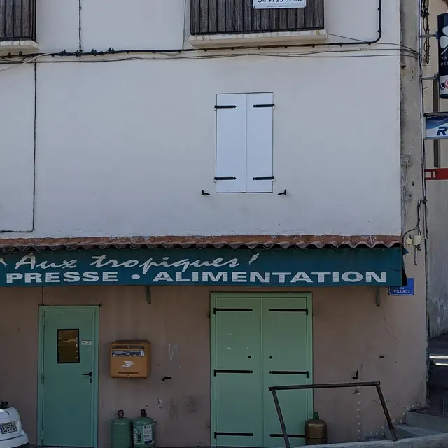
eglise_Eoures©hkotlcm.jpg
3 Commerce aux Tropiques
It was here in 1938 that Marcel Pagnol's "Le Schpountz" (Fernandel) was filmed, a scene that has gone down in the annals of French cinema. It was the scene in the grocery shop of the uncle who made the famous anchovies of the tropics.
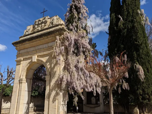
commerce_aux_tropiques©hkotlcm (2).jpg commerce_aux_tropiques©hkotlcm (1).jpg
4 Gate, place des Camoins
Built in the middle of the 18th century, it is made of yellow stone from La Couronne, a limestone from the Côte Bleue region that is easy to recognise because it often contains inlays of shells, small seashells and oysters. Before it was reused here in the square, this gateway adorned the entrance to the former chapel of the Pénitents Blancs, which was demolished in 1979 and located a little further on, across from the chapel.
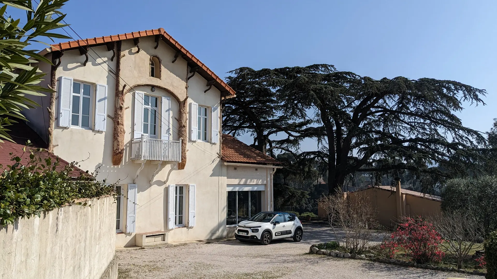
portail de l'ancienne chapelle des Pénitents Blancs aux Camoins©hkotlcm (2).jpg
5 House at nr 63 traverse de la Penne
Stop for a few minutes to admire the inspired work of the master Rocailleurs. The façade gives the impression that two tree trunks frame the first-floor balcony, but they are merely decorative elements. Life must be very peaceful in the shade of the majestic cedars that stand in the property's garden!
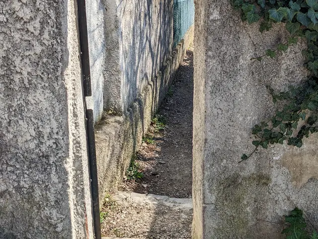
maison avec rocailles©hkotlcm.jpg
6 Covered passage
Located shortly after No. 27 of the Saint-Menet crossroads.
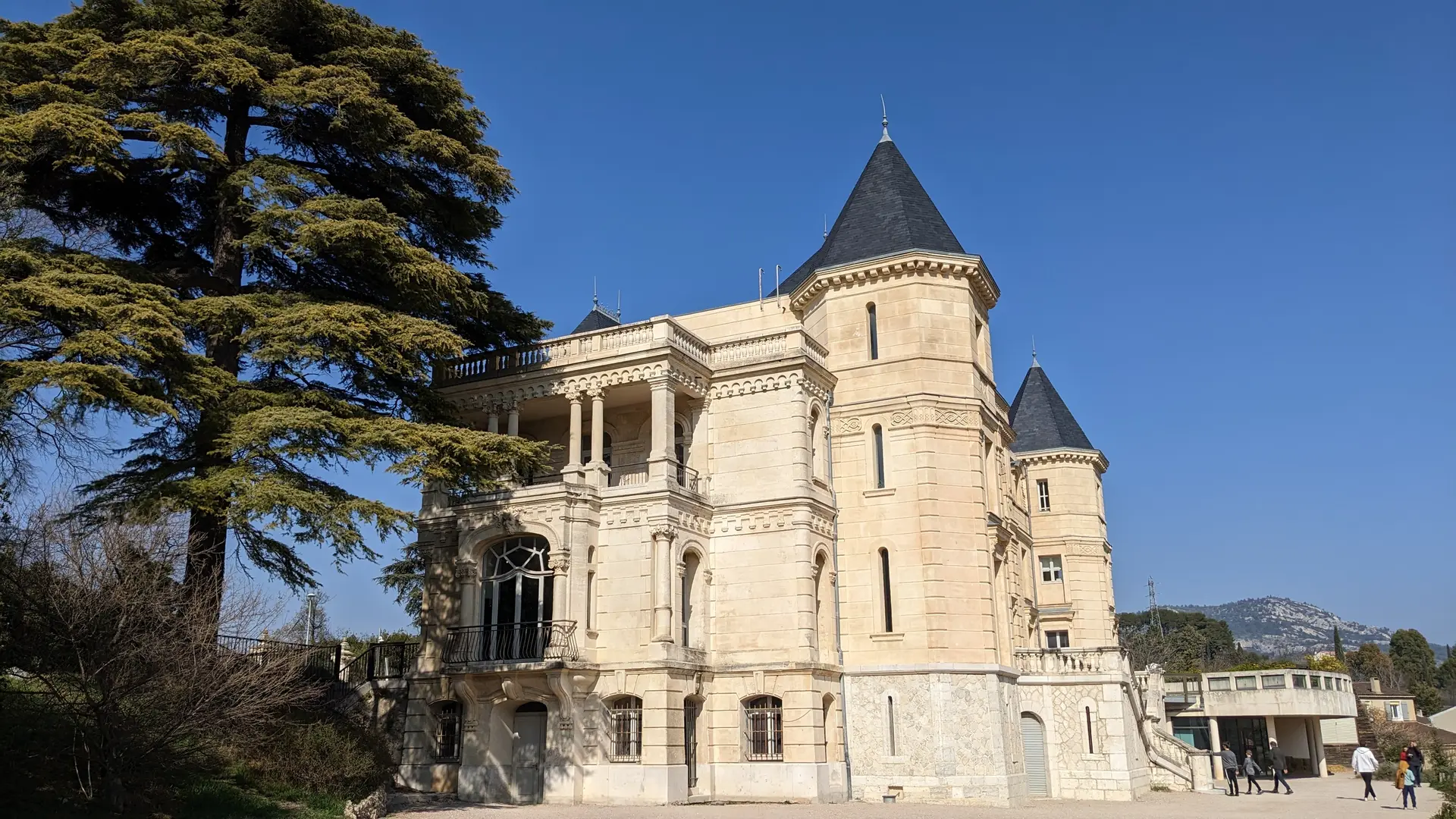
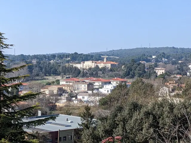
passage dérobé à la Pagnol©hkotlcm.jpg
9 Viewpoint on the Lycée Paul Mélizan
You have to look straight ahead into the distance.
Originally, this site was the château des Accates, known as the Galetas. After several changes of ownership, the château became a convent for the Sisters of the Visitation in 1928. In 2000, the nuns abandoned the site and the premises have since been home to the private Catholic lycée Paul Mélizan, previously located in the Vauban district.
point_de_vue_sur_lycée_Paul_Mélizan©hkotlcm.jpg
10 Traverse des Fenêtres Rouges
Rouge was the name of the landowners who owned a farm near La Salette.
11 Old country house la Denise
Bastide_la_Denise©hkotlcm.jpg
100 meters of difference in height
  • Maximum altitude : 154 m
  • Minimum altitude : 74 m
  • Total positive elevation : 100 m
  • Total negative elevation : -164 m
  • Max positive elevation : 68 m
  • Min positive elevation : -71 m
Services
  • Services
    • Pets welcome
Close