Aller au contenu principal
Accessibilité
Search
en
Visitors
Travel trade
Press
Groups
Convention Bureau
Hotels
Citypass
Visits & experiences
Discover Marseille
The must-see places in Marseille
The Frioul Islands and the Château d'If
The Calanques of Marseille
'Notre-Dame de la Garde' basilica
Beaches and swimming
Other desires
Parks and gardens in Marseille
Culture and heritage
Traditions
Organize your stay
Finding accommodations
Restaurants in Marseille
Where to go out, where to have fun?
All activity providers
More information
Marseille sustainable
Access and practical information
Blog Marseille
Blog Marseille
Outings Marseille
Marseille sustainable
Sustainable shops and craftsmen
Guide of the green tourist
Sustainable accommodation in Marseille
Sustainable restaurants in Marseille
Sustainable travel offers
The Marseille Explorer's Guide
Assessing the carbon footprint of your trip
Our sustainable tourism action
Give us your opinion
Homepage
Discover Marseille
Calanques, beaches and nature
Hiking
Dans les collines de Châteauneuf-les-Martigues
Dans les collines de Châteauneuf-les-Martigues
Sport
Pedestrian sports
Hiking itinerary
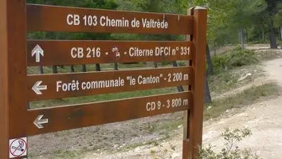
Parking du vallon du Saut, 13220 Châteauneuf-les-Martigues
Getting there
×
Open the itinerary in
Google Maps
Apple Plans
Waze
Mappy
Share
×
Share this sheet
Dans les collines de Châteauneuf-les-Martigues
E-mail
WhatsApp
Facebook
X
LinkedIn
Pinterest
×
Description
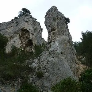
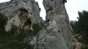
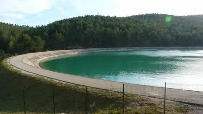
Hiking trail in the hills of Châteauneuf-les-Martigues
All year round.
Close
Popular searches
{% label %}
Filter search
Filter search
Visitors
Professionals
Groups
Convention
Press
Marseille Experience
Page types
All
Articles
Agenda
Lists
Activities
Aucun résultat
/
English
Français
Español
Italiano
Deutsch
中文
日本語
한국어
Close
×