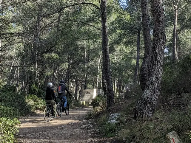
1Wooded valley of la Jarre
It is nestled on the northern slope of the Calanques massif and offers a unique landscape. It consists of two parts. A lower one, made up of pine forests on sand, and an upper part, which houses real dunes. This particularity of finding sand inland is remarkable, usually reserved for coastal areas. Unfortunately, the beauty of this place has been marred by the proliferation of illegal developments such as bumps, ramps, and circuits intended for mountain biking jumps. These clandestine constructions have a destructive impact on the ecosystem, altering the natural environment through shovel blows and repeated bike passages. To preserve the ecological richness of the valley, the Calanques National Park has engaged in dialogue with mountain bikers to raise awareness of the importance of protecting the site and to firmly remind them of the prohibition of creating such developments.
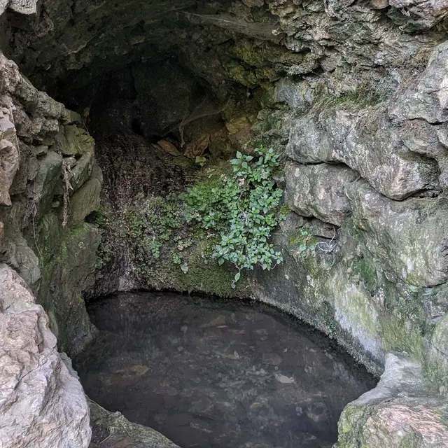
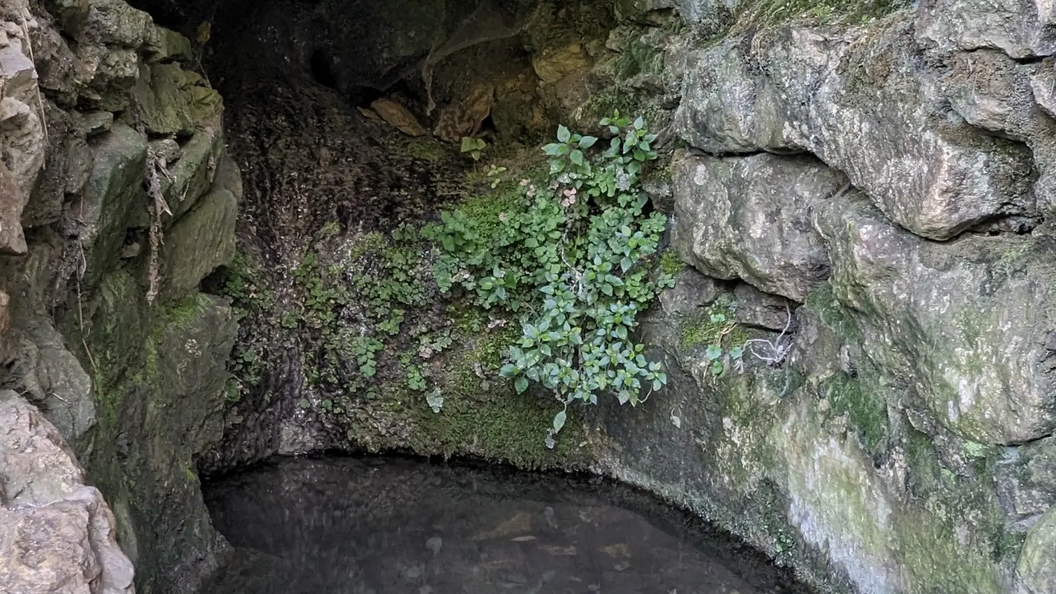
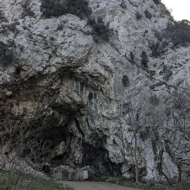
2The Voire Fountain
Throughout history, humans have frequented this symbolic site in the Marseilleveyre massif as it was a passage point to reach the sea. The fountain is located in a kind of rock shelter, dominated by a high limestone cliff. Modifications made over time have altered the site's original appearance. Although the spring is now clearly visible from the trail, this has not always been the case. Previously, a giant ivy created a striking contrast in this wild landscape. The water flow fluctuates greatly depending on the seasons. The water is collected in two reservoirs, the second supplied by the overflow of the first. But nowadays, it is rare for them to fill up. Moreover, the shepherds of the Calanques have disappeared and there are no more sheep to water. Only wildlife and hikers' dogs still benefit from the opportunity to quench their thirst here. The name "Voire" is linked to a farm formerly located downhill. André Voire, a doctor from the nearby village of Mazargues, is said to have lived here between the 17th and 18th centuries, and he is said to have given his name to the valley, the fountain, and a shepherd's hut that has since disappeared. To discover all the details of this exceptional place, we invite you to read the detailed chapter in the book "Once Upon a Time in the Calanques, the Secret Files of the Calancoeurs".

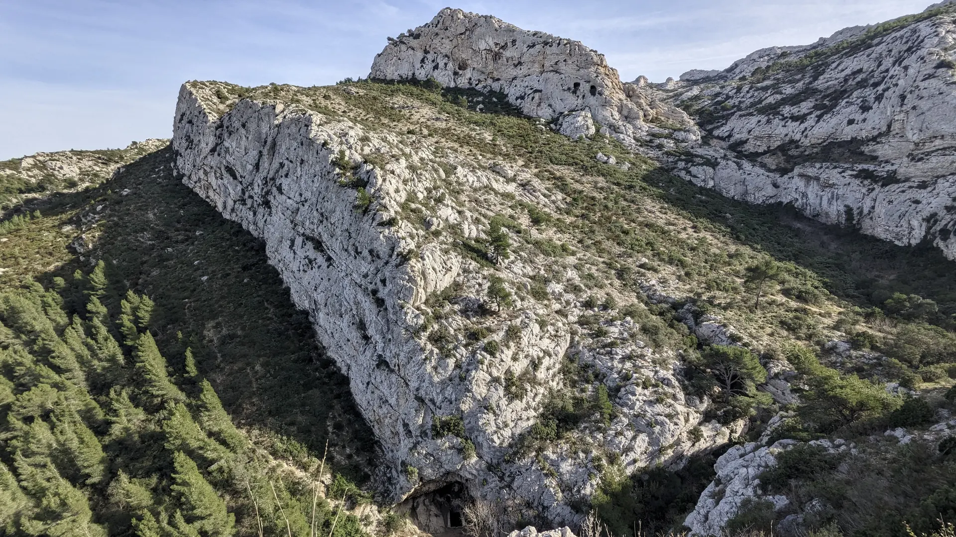
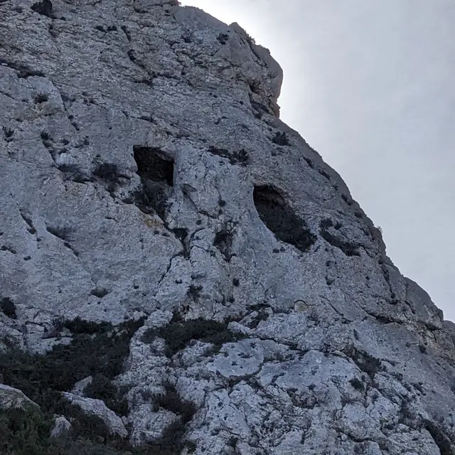
3The Dechaux Cave
These two large holes in the rock face, which illuminate a cave, bear the name of a certain Xavier Dechaux. The story of his life, intimately linked to the calanques, hides an extremely tragic fate. He was born in Sisteron on May 22, 1824. His father, who worked as a customs officer, was stationed at the customs post of La Madrague de Montredon when he was 8 years old. It was while accompanying him on his rounds that Xavier seems to have discovered the paths and iconic sites of the Calanques. More than thirty-five years later, he returned to leave his mark by engraving his name in various places in the Marseilleveyre massif. His destiny was marked by tragedy, as throughout his life, fate inexorably pursued him. A wood turner by trade, he married in Marseille at the age of 25 to the daughter of a customs officer. The couple had 7 children born between 1850 and 1861. 6 of them were declared stillborn or died very young. In 1861, their 7th child, François, survived, but in 1862, Xavier lost his 37-year-old wife. While Xavier was widowed and the father of an 18-month-old baby, the youngest child also lost his life. Xavier was then 39 years old and his entire family was decimated. Knowing that he also lost his mother at 14, his father at 24, and a brother during the Crimean War. He then returned to live in Sisteron, where he began engraving poems in the surrounding mountains. His trace is found in Marseille in 1864. This date marks the beginning of a four-year mystical wandering, during which he left his mark through his rock engravings in the Calanques. In a corner of this difficult-to-access cave, rudimentarily equipped, equipped with a few objects, the police discovered in a tomb-shaped hole, a decomposed corpse. It's Xavier Dechaux. The man planned his death, engraved his tombstone on which he declines his identity and shoots himself in the face with a pistol. Afraid of missing, he had put a rope around his neck. Today, the territory of the National Park has about ten engravings, among which is a love poem dedicated to Marseille, engraved at the top of Marseilleveyre. There would still be much to write about Xavier Dechaux. Especially about the enigmatic text, composed only of initial letters found on the marble plaque. Members of the association "les Calancoeurs" conducted a remarkable investigation, detailed in their work.
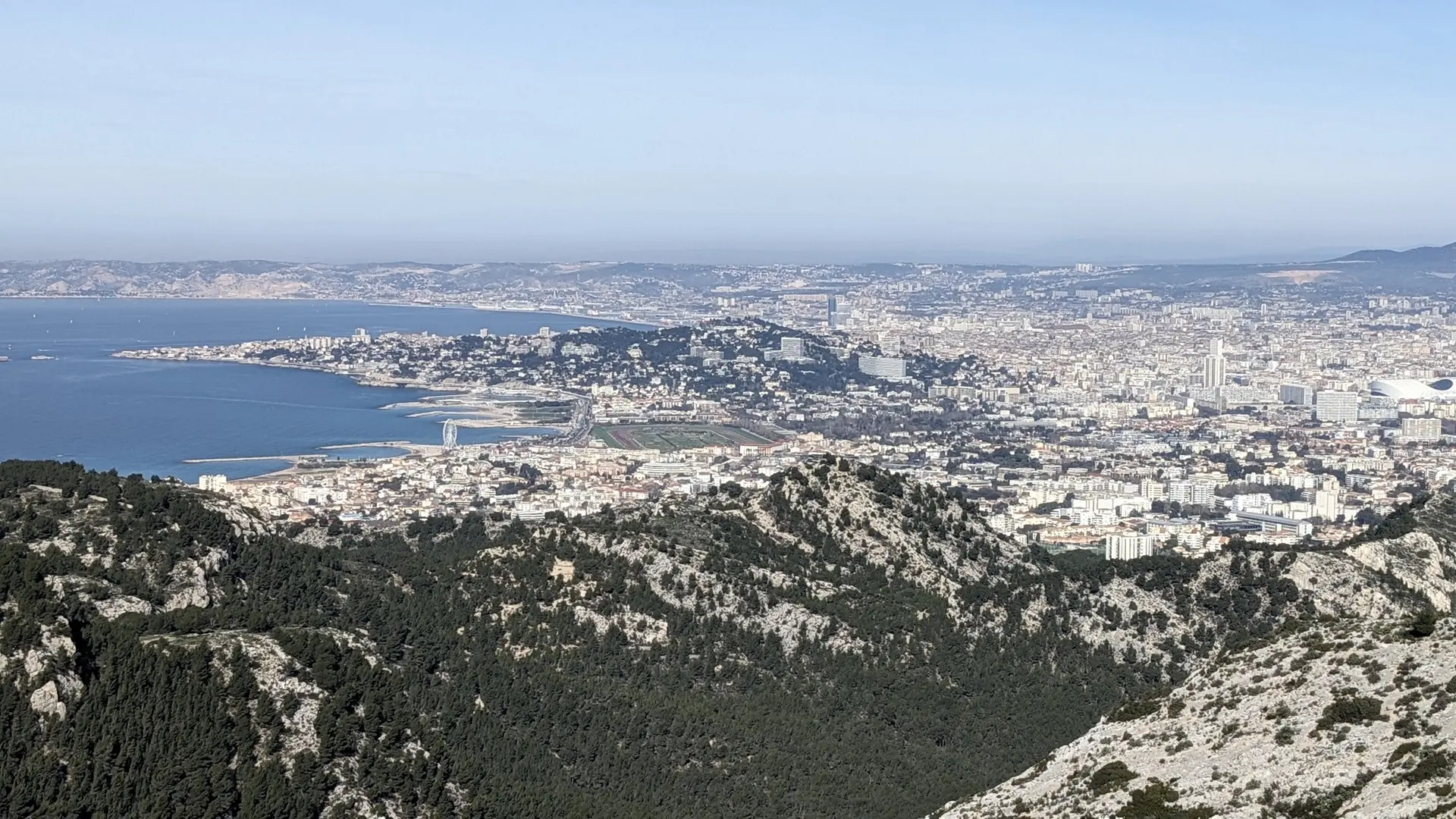
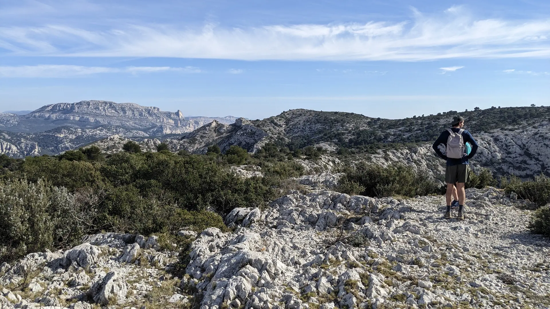
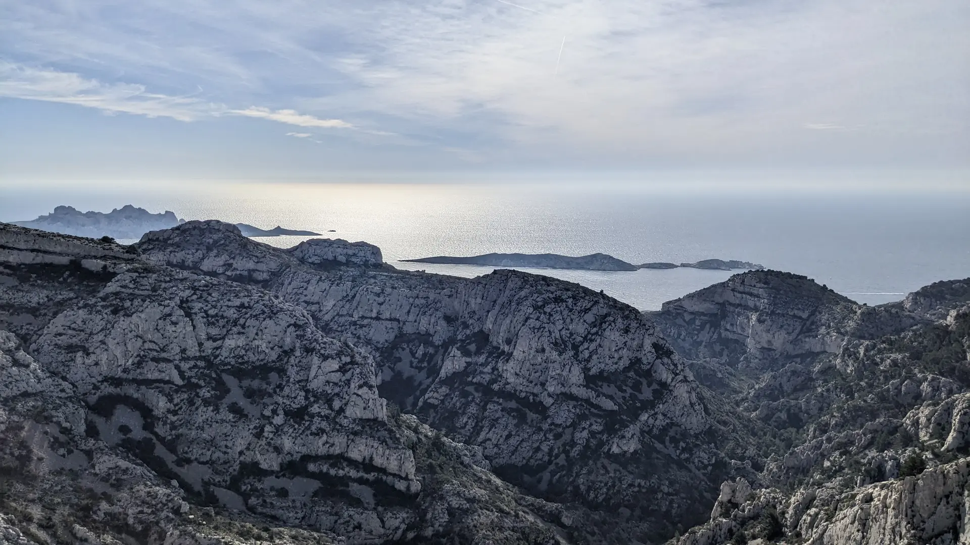
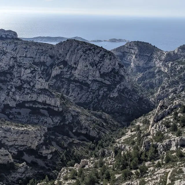
4The Dead Man's Plateau
This place corresponds to the summit of the valley of the dead man, in the extension of the valley of La Jarre, after the fountain of Voire. It overlooks all the calanques on the south and east side. Some believe that this designation is linked to the fate of a shepherd who was found asleep, then dead, leaning against a pine tree, by a fisherman who passed by the summit every day to reach the calanque of Podestat. This story is drawn from one of the novels by Ely Boissin, a Marseille author who has always lived in Mazargues, and it was entirely invented. It is much more plausible to believe that this name comes from Xavier Dechaux and his suicide in 1868, if one relies on the research and discoveries of the Calancoeurs. Again them! The life and work of Xavier Dechaux cannot leave you indifferent. They argue as evidence that until the mid-19th century, on maps, the valley above the cave and the plateau overlooking it were named "the man's valley" and the "man's head". It was only from the end of the 19th century that the names "valley of the dead man" and "plateau of the dead man" began to appear on maps. In 1868, the discovery of Xavier Dechaux's body and his suicide, staged in a very macabre way, caused a stir in the village of Mazargues. The inhabitants certainly talked about it for decades. And even today, this tragedy remains vivid in the memories of the elderly.
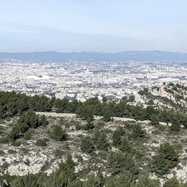
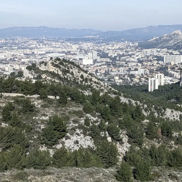
6Wall
This wall, which extends from the valley of La Jarre and winds its way here, once served as the boundary of the estate of the Château du Roy d'Espagne (now disappeared). If you walk with locals from the neighborhood, they may refer to it as the "Barry's wall", in reference to before the Second World War, to the former owner of the estate of the Roy d'Espagne. This wall enclosed the vast property all the way to the hills. During partridge, pheasant, or hare hunting seasons, it was of utmost importance to preserve the species on his land and prevent them from escaping to the neighbors... A nearly bygone era.