Aller au contenu principal
Accessibilité
Search
en
Visitors
Travel trade
Press
Groups
Convention Bureau
Hotels
Citypass
Visits & experiences
Discover Marseille
The must-see places in Marseille
The Frioul Islands and the Château d'If
The Calanques of Marseille
'Notre-Dame de la Garde' basilica
Beaches and swimming
Other desires
Parks and gardens in Marseille
Culture and heritage
Traditions
Organize your stay
Finding accommodations
Restaurants in Marseille
Where to go out, where to have fun?
All activity providers
More information
Marseille sustainable
Access and practical information
Blog Marseille
Blog Marseille
Outings Marseille
Marseille sustainable
Sustainable shops and craftsmen
Guide of the green tourist
Sustainable accommodation in Marseille
Sustainable restaurants in Marseille
Sustainable travel offers
The Marseille Explorer's Guide
Assessing the carbon footprint of your trip
Our sustainable tourism action
Give us your opinion
Homepage
Discover Marseille
Calanques, beaches and nature
Hiking
GR2013 - Boucle de l'Etang de Berre
GR2013 - Boucle de l'Etang de Berre
Sport
Pedestrian sports
Hiking itinerary
Gare TGV d'Aix en Provence, D9F, 13100 Aix-en-Provence
Getting there
×
Open the itinerary in
Google Maps
Apple Plans
Waze
Mappy
Share
×
Share this sheet
GR2013 - Boucle de l'Etang de Berre
E-mail
WhatsApp
Facebook
X
LinkedIn
Pinterest
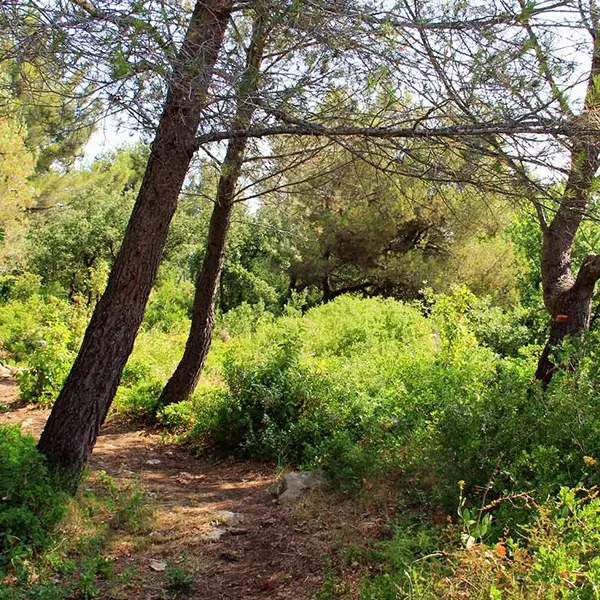
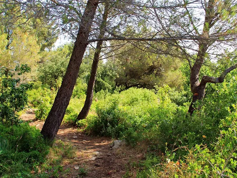
Description
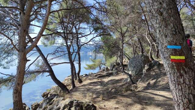
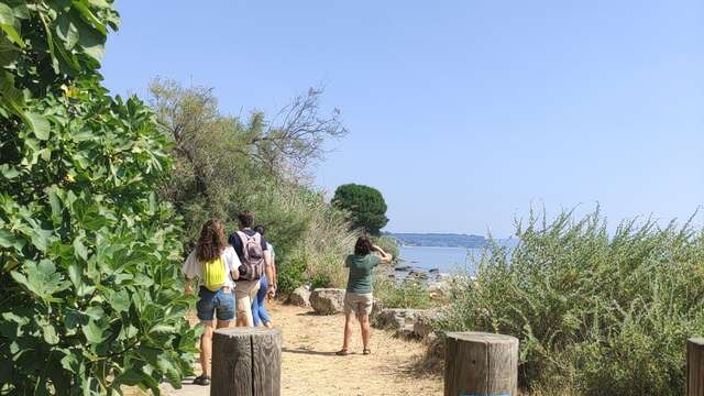
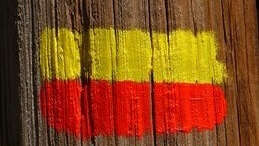
Loop around the Etang de Berre. Corresponding to loop A of the Grande Randonnée GR2013 itinerary. 152km for 20 days of roaming, access via numerous stations.
Accepted customers
Level red – hard
All year round.
GR2013 - B09 - From Aubagne to Gémenos
Section A05 of the GR2013. From Châteauneuf-les-Martigues to Martigues. A 13.3km route to discover the Côte Bleue massif, on the Etang de Berre side.
Châteauneuf-les-Martigues
GR2013 - A06 - From Martigues to Croix Sainte Station
Section A06 of the GR2013. From Martigues to Croix Sainte station (Martigues). A 7.1km route to discover the industrial landscape of Martigues.
Martigues
GR2013 - A07 - From Gare de Croix Sainte to Port de Bouc
Section A07 of the GR2013. From Gare de Croix Sainte (Martigues) to Port de Bouc. A 3.7km route to discover a natural and industrial landscape.
Martigues
GR2013 - A11 - From Les Heures Claires (Istres) to Miramas
Section A08 of the GR2013. From Port de Bouc to La Mérindole. A 5.3km route to discover the industrial complex of the Port of Fos.
Port-de-Bouc
GR2013 - B13 - From Peypin to Mimet
Section A09 of the GR2013. From La Mérindole to Le Ranquet (Istres). A 12.3km route to discover 4 ponds and the archaeological site of Saint-Blaise.
Port-de-Bouc
GR2013 - A08 - From Port-de-Bouc to La Mérindole
Section A10 of the GR2013. From Ranquet beach south of Istres to Port des Heures Claires (Istres). A 3.2km route to discover the coastal path along the Etang de Berre, with its...
Istres
GR2013 - B08 - From La Penne sur Huveaune to Aubagne
Section A11 of the GR2013. From Port des Heures Claires (Istres) to Miramas. A 12.3km route to discover the Etang de Berre, then the Etang de l'Olivier and the hill of...
Istres
GR2013 - A01 - From Aix TGV train station to Vitrolles
Section A12 of the GR2013. From Miramas to Grans. An 8.9km route to discover the Pont de Rhaud massif.
Miramas
GR2013
A 365 km long Grande Randonnée de Pays route in the Bouches-du-Rhône region. Specially created for MP2013, the European Capital of Culture, the GR2013 crosses 39 communes from...
Aix-en-Provence
GR2013 - Loop of the Massif de l'Etoile
192 km loop around the Massif de l'Etoile. Corresponds to loop B of the Grande Randonnée GR2013 itinerary. 10 days of roaming, access via numerous stations.
Aix-en-Provence
Close
Popular searches
{% label %}
Filter search
Filter search
Visitors
Professionals
Groups
Convention
Press
Marseille Experience
Page types
All
Articles
Agenda
Lists
Activities
Aucun résultat
/
English
Français
Español
Italiano
Deutsch
中文
日本語
한국어
Close
×