This moderate hike (12km, 4h) takes in the hills behind the famous seaside resort of Carry-le-Rouet: the Estaque chain.
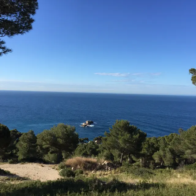
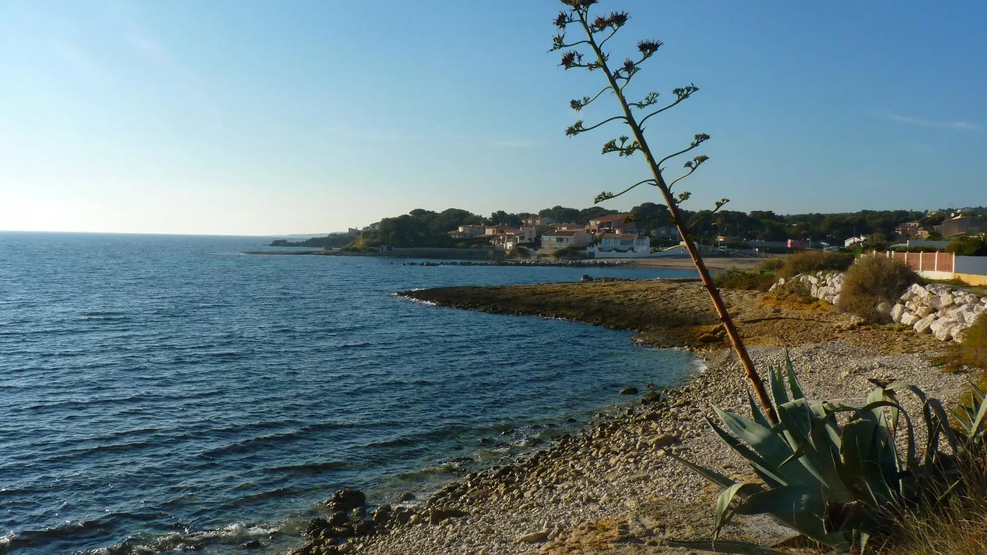
This easy trail alternates between valley-bottom paths and wide tracks. Following a fire some 30 years ago, a low scrubland of kermes oak, rockrose, valerian and fragrant rosemary has developed on this white limestone rock, affording fine views of the Mediterranean Sea. On the way back, take the "sentier du lézard" (lizard trail), a path in the Côte Bleue regional marine park, lined with ten commentary boards on the flora and fauna of the seaside.
Walk down Avenue Pierre Semard for around 200 m, then turn right into Rue des Ecoles, crossing a small white bridge. At the bottom of the street, turn right onto chemin du Jas Vieux, which you will follow to its end.
Go through a barrier and enter the cylindrical tunnel under the D9 Côte Bleue expressway. At the old quarry, go straight on up the path lined with rockroses, valerian, kermes oaks and rosemary. It winds through a valley that was ravaged by fire 30 years ago. On the ground, notice the ruts made by cartwheels, evidence of an industrial past (transporting large blocks of stone). Entering the hill
Leave the yellow trail and continue along the path on the right, which follows another valley. Then take the 2nd path on the left (between 2 rows of pine trees). It bends to the left, reaches a small pass and then joins the blue ridge path. View of the sea and the village of Ensuès-la-Redonne. Follow the ridge in a flat N-W direction. Pass under the high-voltage power line (to the right of a pylon).
You come to a crossroads (stele of Marcel le chasseur and rusty old fence). Turn left onto a wide dirt track (yellow and blue). After a pylon, take the right-hand track, which continues flat on the Chemin de Valprête. Follow the small yellow gas line poles for 20 minutes, until you come to a rusty cistern.
At the crossroads of the rusty cistern and 4 paths, take the small path furthest to the left at the corner of a beautiful pine tree, which descends for 25 minutes into a stony, pine-wooded valley. It joins a path coming from the left. Continue straight downhill (blue line). Then pass under another cylindrical tunnel of the Côte Bleue D9 expressway (be careful, it can be wet and very slippery!), skirt it on the left for 100m, then turn right on a good path due south. You'll come to a dirt track on the left, which runs along a telephone line (wooden poles). Stay on this main track until you reach a fork, where you'll see 2 telephone masts.
At the fork, in sight of the 2 telephone masts, follow the wooden telephone poles to the right along a wide blue track below. Follow the Club Canin Saussétois. Cross the tarmac road and level crossing. Continue on Avenue de Lariano, Sausset-les-Pins commune, which joins the seafront and the GR, which you follow to the left on Avenue de l'Europe D5 as far as the Carry-le-Rouet entrance sign.
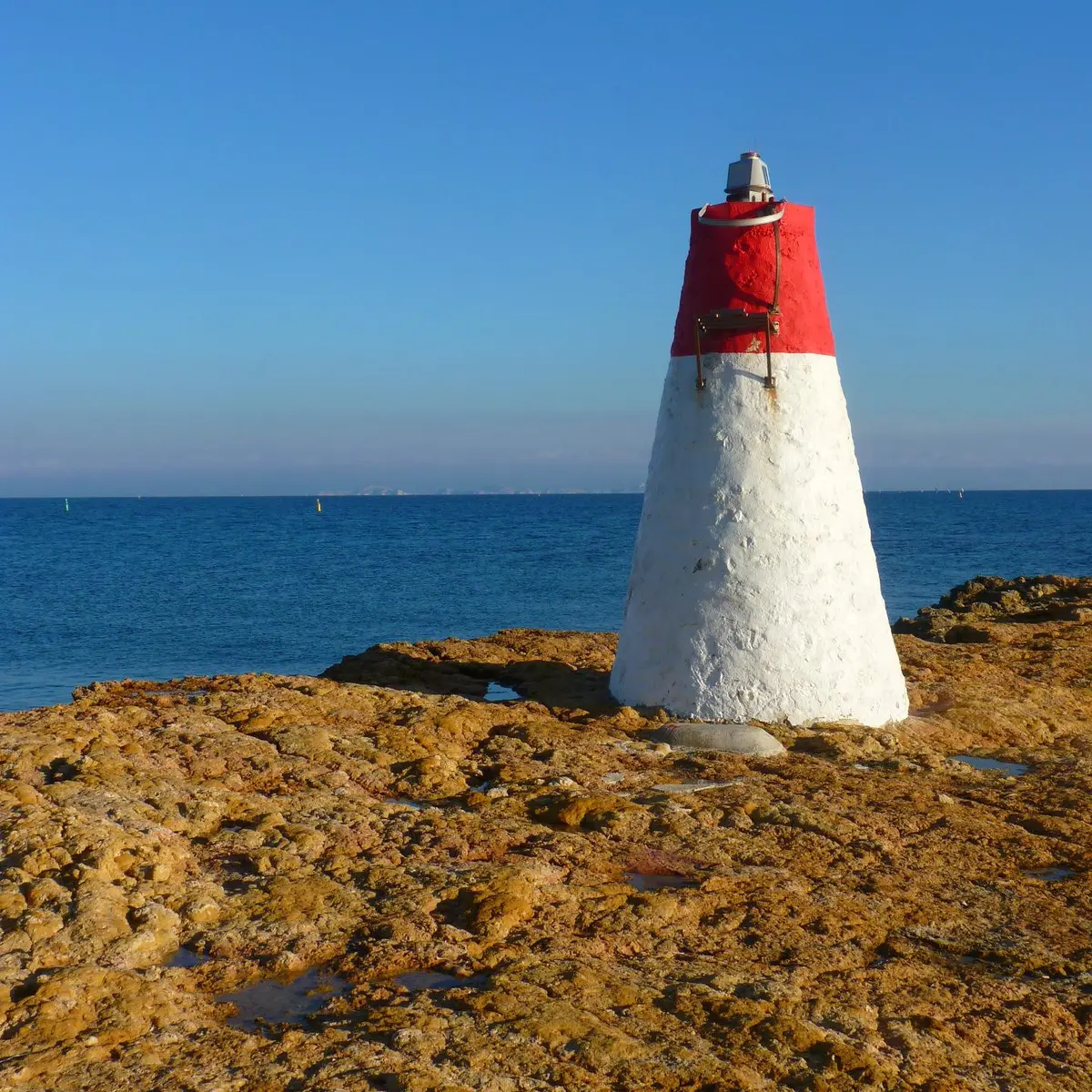
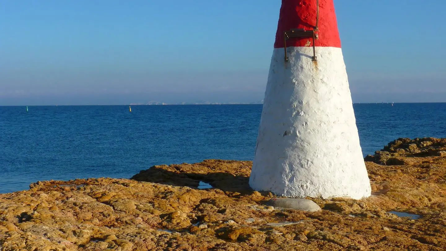
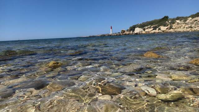
Leave the D5 at the Carry-le-Rouet entrance sign and the plage des Baumettes. Still on the GR, follow the coastal path along the "piste du Lézard", which runs pleasantly alongside the sea to the port of Carry. This educational trail, part of the Côte Bleue regional marine park, features 10 information points on a variety of themes (aquatic flora and fauna, plants, shrubs, erosion, fossils, cicadas and green lizards), and is sure to amaze you! Magnificent views over the Côte Bleue to Marseille. After the pretty little red-and-white lighthouse and the inviting sandy coves perfect for swimming, arrive at the port of Carry via the Quai Malleville and walk past the Casino Municipal. Turn left onto Avenue Aristide Briand and pass the Espace Fernandel cinema. Take the yellow route along the boulodrome to the railway station.