See photos (6)

The Garlaban

Sport, Pedestrian sports, Hiking itinerary in Aubagne
11.8 km
  • This hike leads to the summit of Garlaban, where you can discover the Douard engravings.

  • The Garlaban, which rises to 714 metres, is easily distinguished when you're in the south-eastern part of the Bouches-du-Rhône département. Whether arriving from Toulon or from the sea, it dominates the landscape. Its shape is so distinctive that it served as a landmark for sailors navigating the Marseilles roadstead. Some even describe it as the crown that sits atop a hill so dear to Aubagne-born writer Marcel Pagnol.

    The Garlaban and its surroundings, whether in Marseille or Aubagne,...
    The Garlaban, which rises to 714 metres, is easily distinguished when you're in the south-eastern part of the Bouches-du-Rhône département. Whether arriving from Toulon or from the sea, it dominates the landscape. Its shape is so distinctive that it served as a landmark for sailors navigating the Marseilles roadstead. Some even describe it as the crown that sits atop a hill so dear to Aubagne-born writer Marcel Pagnol.

    The Garlaban and its surroundings, whether in Marseille or Aubagne, were Marcel Pagnol's favorite playground as a child. He later made it a central element in his work. Let's recall the opening lines of his first novel, "La Gloire de mon père": "I was born in the town of Aubagne, under the goat-crowned Garlaban, at the time of the last goatherds. Garlaban is an enormous tower of blue rock, planted on the edge of the Plan de l'Aigle, the immense rocky plateau overlooking the green Huveaune valley. The tower is a little wider than it is tall: but as it rises out of the rock at an altitude of six hundred meters, it towers high into the Provencal sky, and sometimes a white July cloud comes to rest there for a moment. So it's not a mountain, but it's no longer a hill: it's Garlaban."

    The starting point for the hike is at the "Gastaude" bus stop, where there is also a parking lot.

    Join the Chemin du Ruissatel and follow the brown signposted path "Font de Mai, sentier Marcel Pagnol".
    Enter the Font de Mai park and pass in front of the large bastide. After the bastide, fork left to join the Font de Mai road, which you can follow along a path that runs between oak and pine trees. You'll pass an excellent gourmet restaurant, l'Auberge la Ferme.

    At the crossroads with Chemin du Ruissatel, continue straight ahead on Chemin de la Font de Mai, which winds its way up to Col d'Aubignane. From here, follow the yellow markings to the Garlaban.

    Shortly afterwards, there's a narrower path on your right. Follow it until you reach a sign suggesting a 100-metre detour to the Manon cave.

    Then return to the gently ascending corbelled path. Pass the Col Salis and continue on to the Pas Garrigue, a small steep slope, as we like them in Provence, to reach the Col du Garlaban. From here, it's just a short climb to the summit of Garlaban. The path zigzags through the garrigue. Yes, it's tough! But the panoramic view from the summit is your reward. It's sublime! An orientation table helps you decipher the landscape at your feet. You are the kings of Provence.

    Return to the Col and turn left onto the wide path leading down to the plain. On either side of the path, you'll discover engraved stones. The path overlooks the Draioulet valley, whose name comes from "petite draille", a reminder that it was once a transhumance route used by shepherds.

    A shortcut takes you straight downhill for 250 metres, avoiding 4 bends, before reaching an intersection where you must turn left to reach the park and the Font de Mai bastide more directly.

    After a 950-meter walk, you reach the edge of a hill. 4 circular cement shapes (remnants of an old high-voltage line support?) are the markers for turning left onto a path that zigzags downhill. Another landmark you'll pass: the ruins of a sheepfold. You then come to a wide DFCI track which you must take to the right, rounding a hill dominated by a rocky peak.

    Keep to the path along the rocky ridge. The Font de Mai estate can also be reached via an alternative route at the bottom of the valley, but the view is less unobstructed.

    Finish the hike by following the same section back to the parking lot or bus stop.

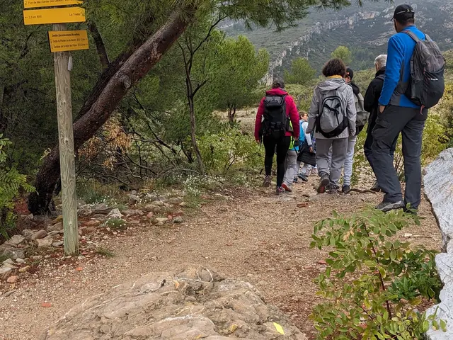
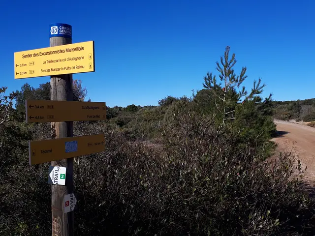
    The Garlaban hiking trails are sparsely wooded. Make sure you bring sun protection (cream and hat) and enough drinking water for all hikers (including dogs). No fountains or water sources.

  • Departure
    Aubagne
  • Difference in height
    532 m
  • Plain text period
    All year round.
    From June 1st to September 30th, access to forest areas is regulated by prefectural decree and may be regulated by municipal decree.
  • Environment
    • Close to a public transportation
    • Panoramic view
    • Sea view
  • Spoken languages
    • French
  • Documentation
    GPX / KML files allow you to export the trail of your hike to your GPS (or other navigation tool)
Points of interest
2 Aubignane pass
The pass of Aubignane resembles a horse saddle, located at 333 meters above sea level. The name of this village, which only existed in the cinema, is that of Aubagne, enriched by 3 letters. Aubignane is the village from "Regain," the work of Jean Giono that Marcel Pagnol adapted into a film in 1937.
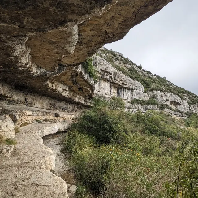
col d'Aubignane©hkotlcm.jpg
3 Plantier, Manon or deer cave
From the Aubignane pass, it takes about 30 minutes of walking to reach the Plantier cave overlooking the Piches valley.

This is one of the natural sites where, in 1952, Pagnol filmed his movie "Manon des Sources," a remarkable work of cinema. The cave served as a shelter where Manon and her shepherdess friend Baptistine lived.

Cinephiles remember the scene of Ugolin's (played by Rellys) declaration of love to Manon (Jacqueline Bouvier-Pagnol), shouted to the winds from the mountaintop. The 1986 adaptation by Claude Berri with Daniel Auteuil and Emmanuelle Béart has also entered the annals of cinema with 2 César awards for the 2 actors.
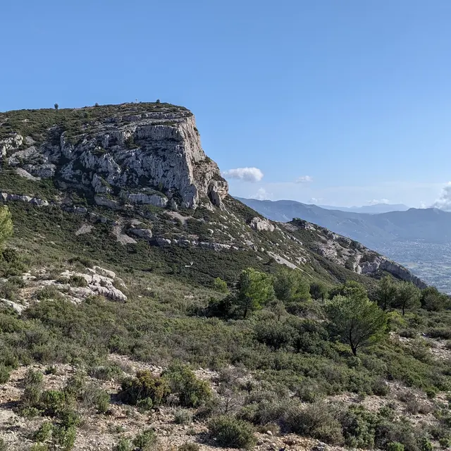
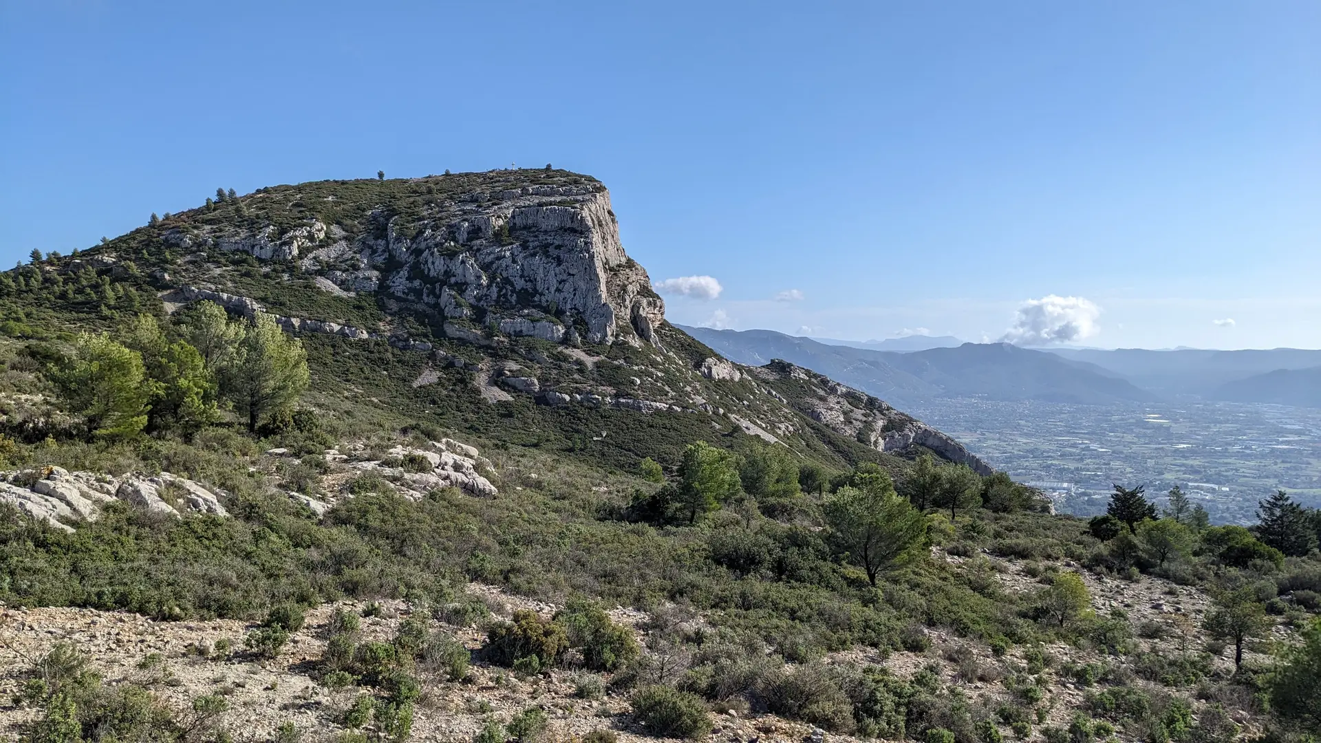
grotte Manon©hkotlcm (2).jpg panneau vers grotte de Manon©hkotlcm.jpg
4 Garlaban pass
The pass is dominated by the rocky spur of Garlaban, which rises to the north-northwest of the town of Aubagne.
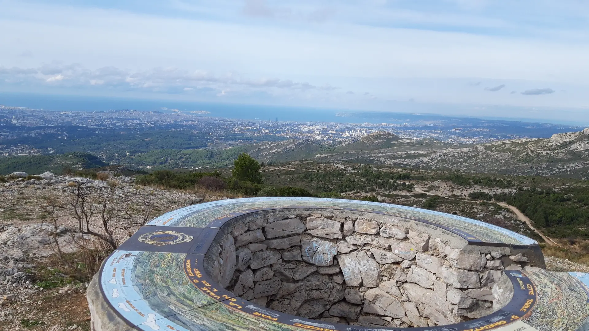
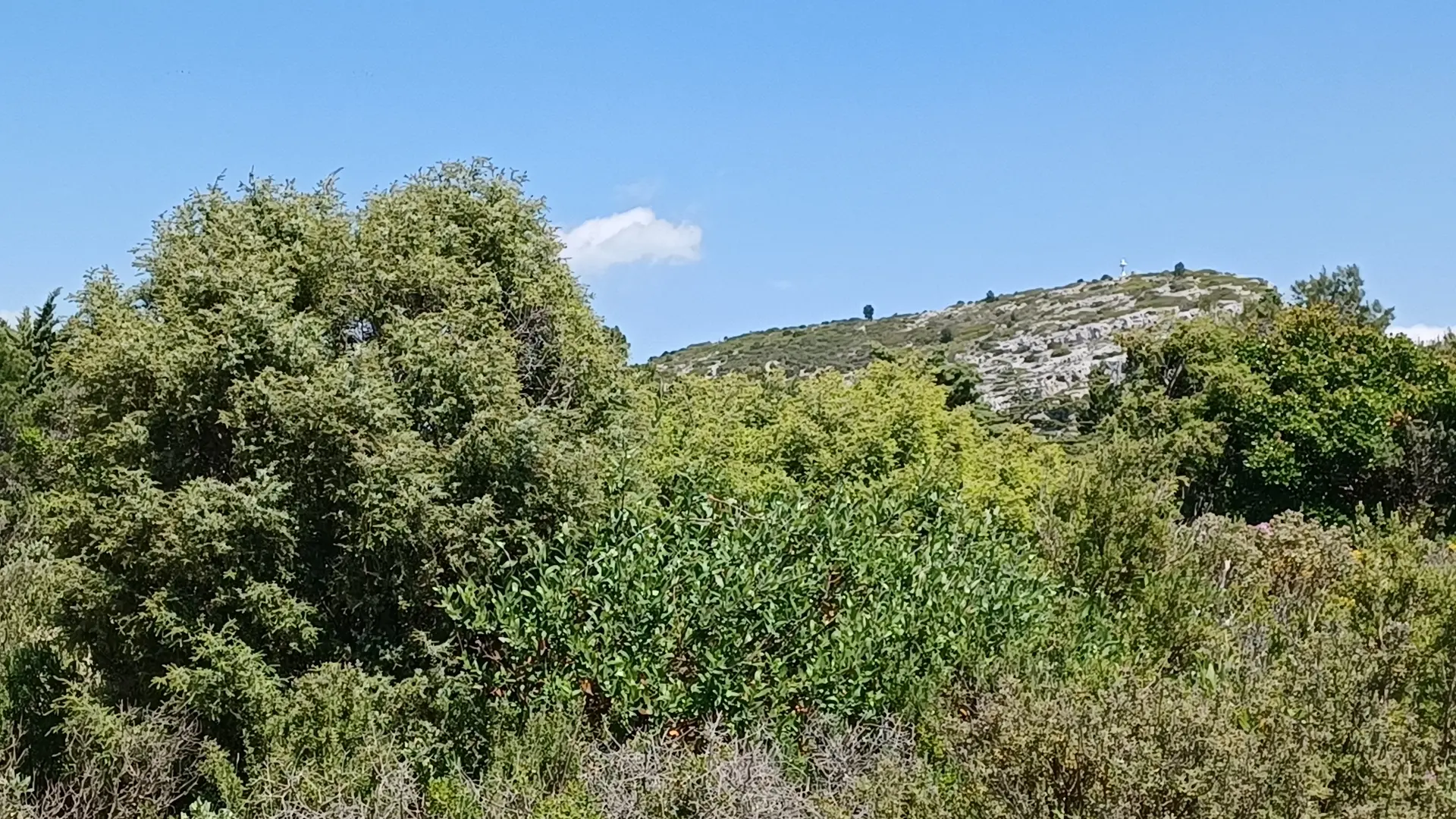
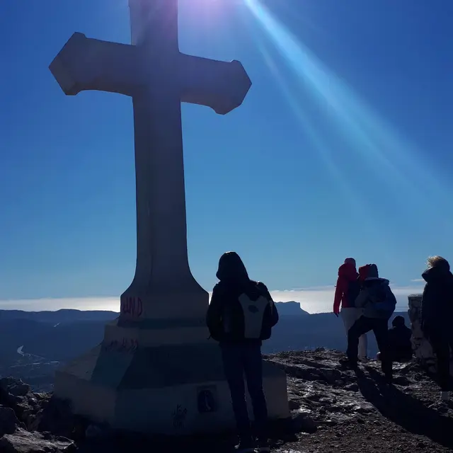
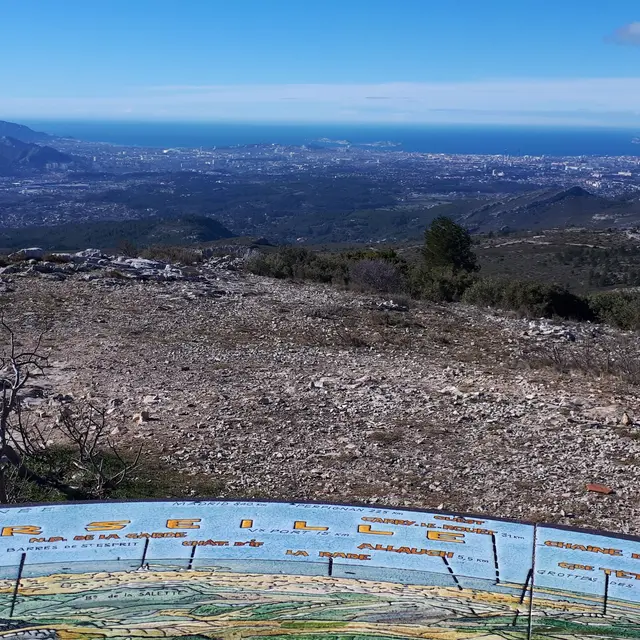
col du Garlaban©hkotlcm.jpg
5 The Garlaban summit, cross and panoramic view
Unobstructed 360-degree view of the surrounding mountain ranges. There is an orientation table and a sturdy white-painted cement cross. According to local tradition, the cross was erected in the 17th century by monks to mark a place of meditation and prayer.
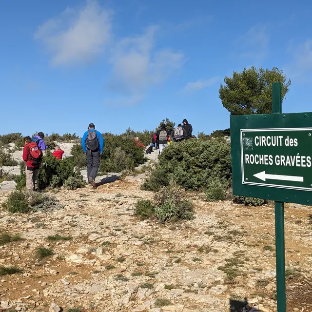
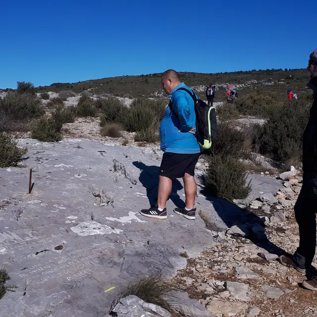
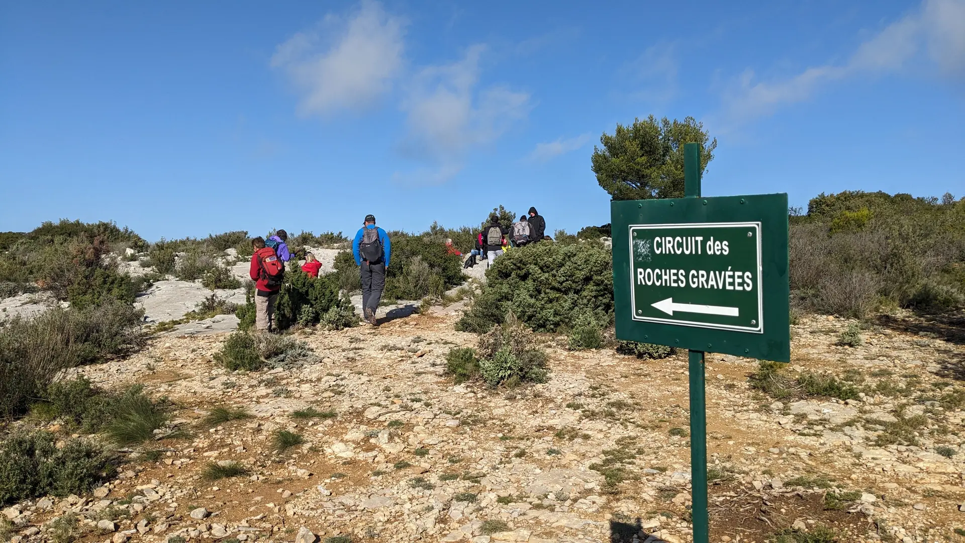
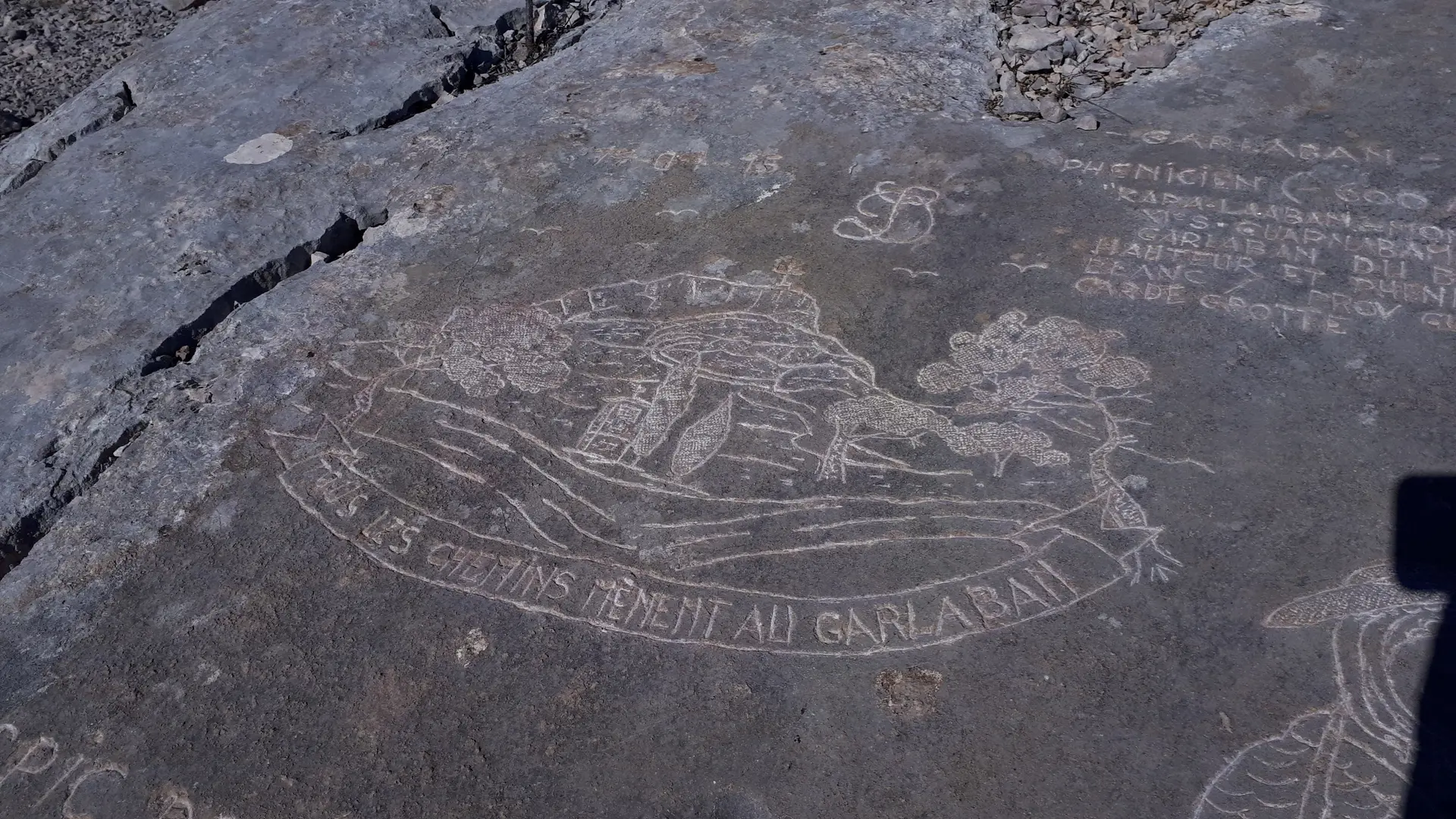
sommet Garlaban©hkotlcm (2).jpg sommet Garlaban©hkotlcm (1).jpg
6 Garlaban's engraving 1
Louis Douard, from Aubagne, is a passionate individual who has set up an open-air engraving workshop at the foot of Garlaban, carving no fewer than 120 engravings into the limestone rocks, directly into the ground. His tools consist of a chisel and a large hammer. His artistic work has given rise to a trail highly appreciated by visitors. His favorite themes include characters and scenes from the works of Pagnol and other subjects specific to Provence. His first three creations are the compass rose, the coat of arms of Provence, and the shepherd with two sheep from his flock. But you can also find excerpts from poems, portraits. It's up to you to discover them. Louis Douard is regularly present at the site and enjoys interacting with hikers.
gravures Drouard_1©hkotlcm.jpg
7 Garlaban's engraving 2
Louis Douard, from Aubagne, is a passionate individual who has set up an open-air engraving workshop at the foot of Garlaban, carving no fewer than 120 engravings into the limestone rocks, directly into the ground. His tools consist of a chisel and a large hammer. His artistic work has given rise to a trail highly appreciated by visitors. His favorite themes include characters and scenes from the works of Pagnol and other subjects specific to Provence. His first three creations are the compass rose, the coat of arms of Provence, and the shepherd with two sheep from his flock. But you can also find excerpts from poems, portraits. It's up to you to discover them. Louis Douard is regularly present at the site and enjoys interacting with hikers.
marquage direction gravures Douard©hkotlcm (2).jpg gravures Douard au Garlaban©hkotlcm (2).jpg
532 meters of difference in height
  • Maximum altitude : 699 m
  • Minimum altitude : 186 m
  • Total positive elevation : 532 m
  • Total negative elevation : -531 m
  • Max positive elevation : 314 m
  • Min positive elevation : -455 m
Services
  • Equipment
    • Car park
    • Public WC
  • Services
    • Pets welcome
      • Dogs must be kept on a leash. They can also suffer from the heat. Don't underestimate this.
Close